
Yuma County Neighbor Record Map
A block lookup works by combining shape, ownership, and civic context. Yuma County GIS defines parcel geometry and nearby rights-of-way. EagleWeb names the assessed owner for each parcel. Recorder filings can show deeds, subdivision declarations, and covenants, conditions, and restrictions, often called CC&Rs. City programs show a public planning area, not a list of members. Each source answers a different question about Yuma County neighbors.
| Source | What it shows about a block | Access route |
|---|---|---|
| Yuma County GIS | Parcel shapes, roads, boundaries, and map context | Official map resources and GIS instructions |
| City General Map | Address points, zoning, subdivisions, annexations, floodplains | Free city map inside city limits |
| Assessor EagleWeb | Current assessed owner, situs, mailing address, parcel history | Free web search or Assessor counter |
| Recorder documents | Deeds, subdivision filings, and recorded CC&Rs | Index, counter, or copy request |
| Voter records | Limited registration fields for an authorized statutory use | Personal portal or formal Recorder request |
| Community Connect | Permits, plans, inspections, and license-case activity | City service inside municipal jurisdiction |
Ownership is not the same as occupancy. The Assessor's situs field is the physical parcel location, while the mailing field is where tax correspondence goes. Matching fields can support an inference, but they do not identify every household member. A different mailing address may belong to an owner, trust, post office box, or agent. Renters may be absent from all property records.
Map Yuma County Neighbors
The official Yuma County GIS instructions support address search, map choice, a Basemap Gallery, Legend, Layers List, location coordinates, and Measure tools for distance and area. The old Silverlight viewer is obsolete, so a Yuma County neighbor search should not assume a live radius button or a fixed set of popup fields. Use only the controls visible in the current map.
- Search the starting address and zoom until parcel lines can be read.
- Define the block. Include touching parcels and the lots directly across the public right-of-way.
- Use Area or Measure to preserve a repeatable extent. Map distance makes the scope clear.
- Copy each available assessor parcel number, or APN, into Yuma County Assessor EagleWeb.
- Record assessed owner, situs, mailing address, and roll year separately. Do not add people whom the roll does not name.
APN means the Assessor's parcel identifier. It is the safest link between a map shape and an assessment account. For a whole named road rather than the near block, use the Yuma County street directory workflow, which follows parcels and deeds farther along the street.
Note: Geometric adjacency defines the map task, but it does not prove that nearby owners know one another or live on the parcel.
Separate Yuma Owners and Neighbors
The most common block-search mistake is turning an owner roll into a household roll. EagleWeb provides current ownership, sales, tax, and assessment history. Those facts serve property administration. An owner-occupied property class still does not identify a spouse, child, roommate, guest, caregiver, or renter. Arizona's automatic homestead protection also is not a public declaration that names a whole household.
A sales-history line can point to a Recorder document. Open the instrument and check the legal description before linking it to the map parcel. The deed may add grantor and grantee roles, a return address, and an APN. Yet its recording date does not prove when someone moved, and a return address tells the office where to send the paper. This distinction matters when the goal is to understand nearby parcels without overstating who lives there.
Ownership myth. A Yuma County assessment owner or owner-occupied class does not reveal the full group of neighbors at an address.
Yuma Block Boundaries Shift
Postal Yuma, city Yuma, and county jurisdiction do not share one edge. The City General Map is the verified companion for locations within city limits. Its address points, subdivision, annexation, zoning, and floodplain layers can explain why the lots across a road have different permit histories. A parcel now inside the city may have older files with County Development Services and newer files with the city.
The 85367 mailing area is a useful Yuma County geography quirk. It carries a Yuma mailing city across much of unincorporated Fortuna Foothills. That label cannot establish city jurisdiction. An annexation layer and the permit date are better tests. Likewise, the postal place attached to an address does not define a neighborhood group or make all nearby parcels part of one civic district.
County permits can be requested by property address or APN, with record type, permit number, and date range when known. City Community Connect can map permit, plan, inspection, and license-case activity. Applicant and contractor names show project involvement, not residence. Use the work dates to understand change on the block, not to assemble a household list.
Yuma Neighbor Program Areas
Yuma Neighborhood Services identifies several revitalization geographies. Mesa Heights is described roughly by 17th Street, Arizona Avenue, 24th Street, and 4th Avenue. The Yuma High area spans 32 blocks within boundaries formed by Colorado Street, Avenue A, 5th Street, and 4th Avenue. Carver Park is also named. These are public program areas, not associations with open resident rosters.
Mesa Heights
A Neighborhood Services revitalization area with published approximate street bounds. Use the program office for area questions, not resident names.
Yuma High Area
A 32-block public program geography. Its listed bounds help place a block within the city's work area.
Carver Park
A named revitalization area. No official public household or membership directory was found in the research.
The City of Yuma neighborhood programs are the direct route for contacts and improvement information. Congregations, civic clubs, and block-watch groups may maintain private lists, but no authoritative countywide public roster was verified. Respect that gap instead of replacing it with a commercial compilation.
Find Yuma County HOA Records
An HOA trail begins with a filed entity, not a guessed neighborhood name. Search the Arizona Corporation Commission for the association's legal name, statutory agent, principal name, entity ID, status, and County of Yuma. Then use the Recorder's index for subdivision declarations and recorded CC&Rs. Those filings may define the governed lots and amendment history.
Open the Arizona Corporation Commission entity search to check the filed association and its current public record.
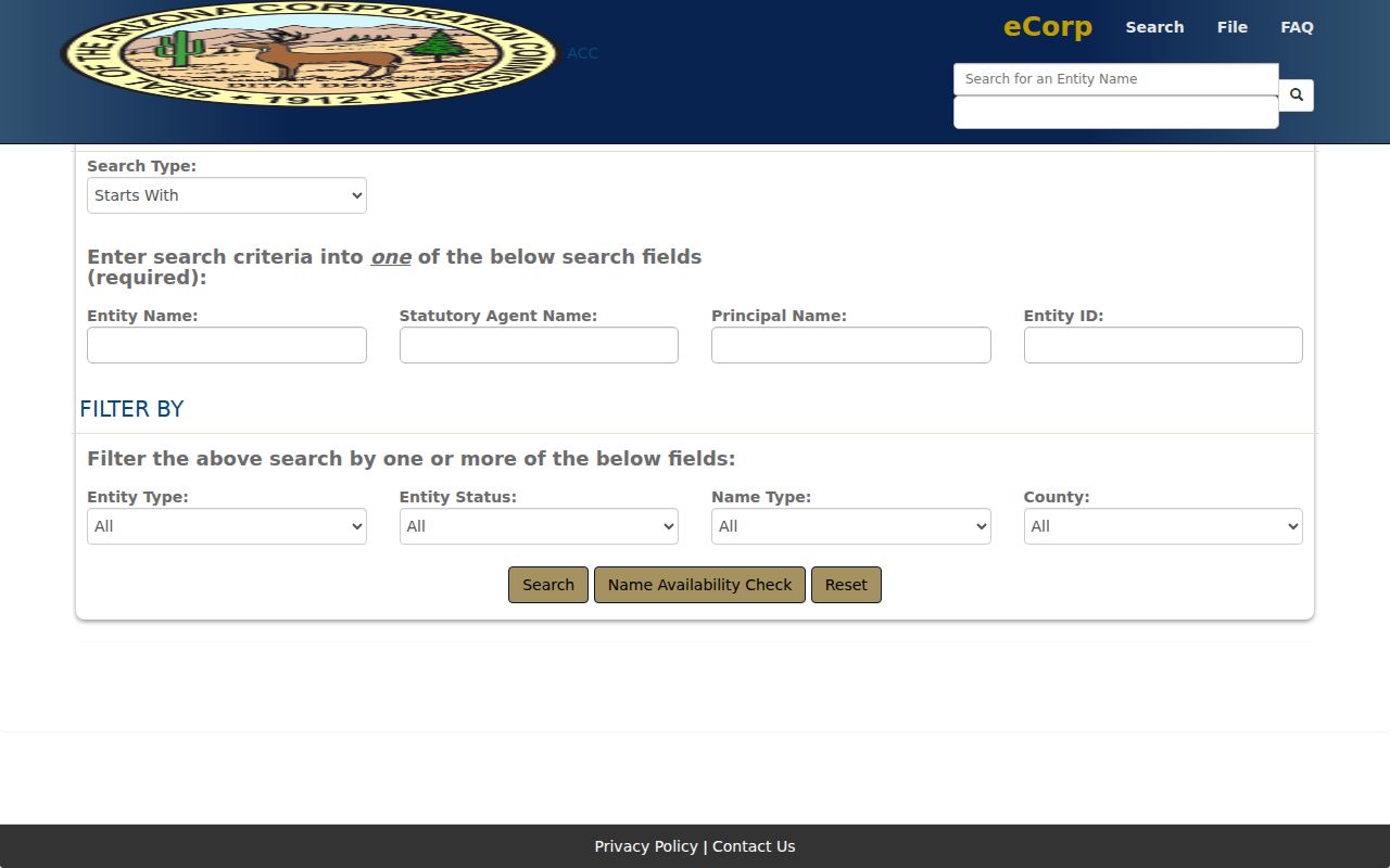
The entity result can identify an agent or principal, but that person's address may be a service address. It does not become a member directory.
Search the Yuma County Recorder public index with the association and subdivision name. Try spelling variants, document type, and date range. The index is only a guide. Inspect the recorded image for the legal description, covered lots, amendments, and release or restatement language. When an old image is missing, retain the instrument or docket and page number for a counter or copy request.
Yuma County Civic Connections
Business directories add a community layer without claiming residence. A chamber entry can confirm a public business affiliation and contact channel. Newspaper social columns, alumni material, and local-history resources can distinguish names over time, especially where seasonal workers were undercounted by standard directories. These are clues about public ties, not a block roster.
Browse the Yuma County Chamber of Commerce when a nearby business or public-facing organization is part of the question.

The captured Chamber directory supports affiliation research, while parcel and deed questions still belong with the county offices.
| Source type | Strength | Key limit |
|---|---|---|
| Official parcel and deed records | Primary evidence of parcel identity and filed ownership | Owner-centered, not a full household |
| Government program areas | Defined civic or planning geography | No member list implied |
| Public organization directory | Published contact or affiliation | May use a business address |
| Commercial neighbor compilation | Convenient lead from mixed feeds | Can lag, merge names, and miss corrections |
Official sources are slower because they preserve the meaning of each record. That narrow meaning is their value. A commercial tool may blend owner, phone, mailing, and other feeds without showing when or why each fact was collected.
Yuma Voter Data Is Limited
My.Arizona.Vote is an identity-gated personal service. Its residence-address mode returns a polling place, not names of Yuma County neighbors. A formal voter-file request goes through Recorder and Voter Services and requires an authorized purpose under A.R.S. § 16-168. Internet redistribution and commercial use are restricted.
Permitted fields can include name, party, registration date, residence, a different mailing address, ZIP, birth year, and a four-year participation history. Participation history says whether someone took part, never how a ballot was marked. Month and day of birth, identification numbers, signature, email, parents, birthplace, and other protected fields are withheld. Address Confidentiality Program and protected registrations remain hidden.
For block-level civic context, aggregate precinct and district statistics are safer than trying to turn an election file into a casual directory. Historical poll books may require an Arizona Room or State Archives inquiry, since no exact Yuma County run was verified.
Protect Yuma County Neighbors
Utility accounts, delivery records, DMV data, and private membership rosters do not become public just because an address is known. Arizona's Address Confidentiality Program provides a substitute government address and mail forwarding for qualifying survivors. Other statutes permit redaction from voter, Recorder, Assessor, and Treasurer records in defined cases.
A missing result may reflect a renter, an unlisted household, a protected address, an obsolete map, or a source that was never meant to identify occupants. Do not fill the gap with a guess. Keep the map extent, APNs, roll year, and links used so the work can be checked later.
Lawful use. Use Yuma County neighbor records for civic curiosity, reconnection, or personal safety. Never use them to watch, harass, threaten, or harm another person.