
Walk a Yuma County Street
A sound Yuma County street directory search moves from the least ambiguous fact to records that need more judgment. First verify how the address is written. Then resolve it to the parcel, the county's stable tax unit. Keep the physical site address apart from the owner's mailing address. The parcel number and legal description provide stronger bridges to deeds, plats, tax accounts, and permits than a street label alone.
The sequence below follows the county's actual record divisions. It produces an owner-and-record trail. It does not create a roster of every person in a home, and it cannot identify renters who never appear in a relevant public source.
- Verify the full postal form, including direction, fraction, suffix, and unit when present.
- Search the Yuma County Assessor EagleWeb situs fields and save the parcel number, legal description, owner, and mailing address.
- Use the Yuma County GIS resources to confirm parcel shape, nearby parcels, roads, and jurisdiction.
- Pivot from the owner or deed reference to the Recorder index, then inspect the instrument and earlier transfers.
- Check the correct city or county permit keeper, then use restricted voter access or a dated reverse directory only when lawful and relevant.
Note: A matching owner mailing address supports occupancy, but only as one clue; it never establishes the full household at a Yuma County parcel.
Search Yuma County by Address
EagleWeb is the main street directory gateway for current property facts. Its Basic and Advanced searches accept more than one form of location. A narrow house-number search can find a single site. Leaving out the number may broaden a street search, while subdivision, lot, block, or Public Land Survey System fields help when rural wording varies. The portal requires JavaScript and cookies, and its values serve assessment work rather than a market-price or resident census.
| Yuma County field | Input | Best street use | Caution |
|---|---|---|---|
| Owner Name | Text | Broaden by surname or business | Owner is not proof of occupancy |
| Account or Parcel Number | Exact text | Open one assessed account | Use the county identifier |
| Situs Address | Number, street, city | Resolve a physical site | Omit a suffix to catch variants |
| Subdivision | Text or choice | Browse a platted area | Not the same as a postal place |
| Legal Description | Text | Bridge changed address wording | Match the parcel, not a surname |
| City/ZIP | Combined field | Narrow stored situs strings | Not a mapped ZIP boundary |
A parcel card can show the roll year, situs, mailing destination, tax area, assessed use, land and improvement values, sales references, and assessment history. Record the year viewed. Roll data changes, and a sale reference is only a shortcut to the recorded instrument.
Yuma County Street Record Layers
The Yuma County street directory becomes more reliable when each layer stays in its lane. The Assessor identifies the assessed party and parcel. The Treasurer shows tax billing and payment data. The Recorder preserves instruments. GIS supplies map context. Development offices hold project files, and a dated reverse directory may name its listed subscriber. None of these sources certifies all people living at an address.
| Address record | Keeper | Street evidence | Ways to reach it |
|---|---|---|---|
| Assessment roll | Yuma County Assessor | Owner, situs, mailing, parcel, legal, sales | EagleWeb, counter, written data request |
| Tax account | Yuma County Treasurer | Billed party, levies, payments, delinquency | Tyler web search or office request |
| Recorded instruments | Yuma County Recorder | Deeds, liens, releases, plats, indexed parties | Tyler index, counter, phone, mail copy form |
| Parcel mapping | County GIS and City GIS | Geometry, roads, subdivision and jurisdiction context | Public maps or GIS staff |
| Permit files | City or County Development Services | Project site, type, dates, applicant and contractor | Portal, written request, counter, phone |
| Reverse directory | Yuma County Library District | Listed subscriber at an address in one edition | Catalog, Arizona Room staff, physical volume |
When the web page fails, ask for the maintained record rather than an office-created analysis. Arizona assessment law supports a written request for electronically kept assessment information. For a deed image, preserve an instrument number or book and page before calling or mailing the Recorder.
Read Yuma County Address Types
A physical property can carry several addresses at once. Treating them as interchangeable is a common street directory error. The situs is the parcel's physical location. The mailing address receives the tax notice. A deed return address tells the Recorder where to send the filed instrument. The legal description identifies land by its recorded subdivision or survey terms, even after postal wording changes.
- Parcel
- The Assessor's defined unit of land, usually tracked by an assessor parcel number, or APN.
- Situs address
- The physical location stored for the taxable parcel, as distinct from the owner's mail destination.
- Plat
- A recorded map that divides land into lots, blocks, roads, and other features.
- Criss-cross directory
- A dated directory arranged by street and house number instead of only by a person's name.
A PO box, trust, agent, second property, or out-of-area owner can explain a mailing mismatch. Conversely, a matching situs and mailing address is still only supporting evidence. Use the legal description and APN to keep the same land in view.
Decode Yuma County Street Grid
Yuma's numbered grid needs exact transcription. The city plan identifies 1st Street as the north-south divider and 1st Avenue as the east-west divider. Numbered Streets tend to run east-west, while Avenues tend north-south. Rural names such as County 9½ Street and Avenue B½ preserve the valley's half-mile and quarter-mile pattern. Fractions, directions, and designations can change the result.
EagleWeb stores house number, directional suffix, street name, designation, direction, suffix, unit, city, and ZIP as separate elements. Search a simpler version first, then add the missing parts. For rural parcels, subdivision or section-township-range data may work when the street form does not.
Grid quirk. City/ZIP in EagleWeb filters stored situs text; it does not draw a ZIP area or establish that a parcel lies inside Yuma city limits.
Tax Records by Yuma County Street
The Yuma County Treasurer tax-account search adds billing, levy, payment, delinquency, and tax-lien context after EagleWeb identifies the parcel. The screen is another official address-keyed record, but the billed name should not be recast as a resident list.
The captured Treasurer public entry page shows the tax search used in this Yuma County street directory:
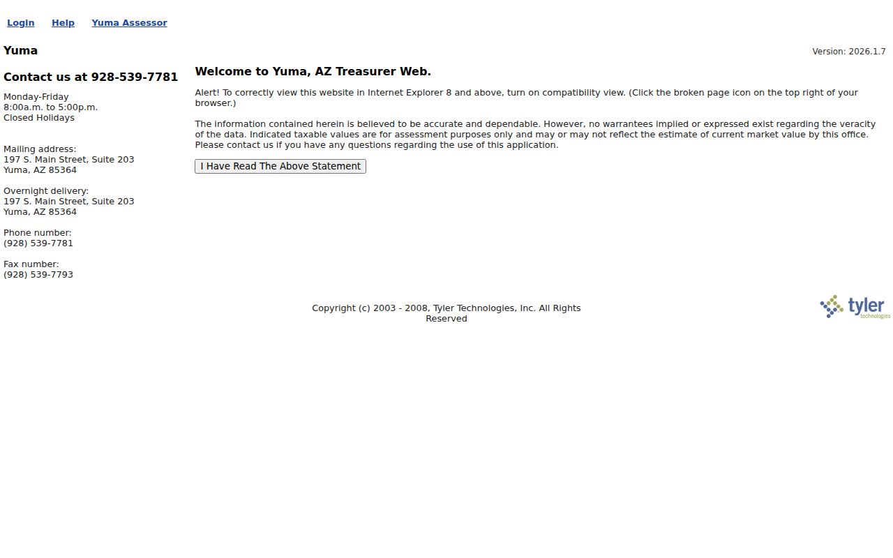
Use its account data beside the same parcel number from EagleWeb. Tax status can explain a later lien or deed, while ownership itself still comes from the assessment roll and recorded instruments. If the web search is unavailable, the Treasurer is the proper keeper for tax-account questions.
Note: Tax classification, payment status, and mailing data describe an account; none identifies all current Yuma County residents at the site.
Link Yuma County Streets to Deeds
The Recorder's Records Public Access index is keyed mainly to parties and recording facts, not to every street address. Begin with the Assessor's current owner, legal description, and sales reference. Accept the portal disclaimer, search name variants, and narrow a broad surname by recording date or document type. Then inspect the image and confirm that its legal description matches the target parcel.
Search modes include party name, recording-date range, instrument number, document type, book and page, and legal or parcel-related criteria when indexed. The Recorder calls the index a guide or card catalog. A hit can represent a deed, release, corrective filing, lien, plat, or affidavit, so its legal effect comes from the instrument and any later filing.
Online access is only one channel. The Recorder at 298 S. Main Street accepts counter requests and can be reached at (928) 373-6020. Its official copy form supports mail requests by document type, date, names, grantor, grantee, book, page, and fee number. Copies cost $1 per page, with $3 added per certified document. Staff may need up to ten working days to locate a requested record and do not build a chain of title.
Yuma County Street Permit Records
Permit access follows jurisdiction and date. The City of Yuma permit service covers sites within city authority. Yuma County Development Services handles unincorporated property. An annexed parcel may have older county files and newer city files, so use map context and the permit date before choosing the keeper.
Ask with the property address, APN, permit type or number, project description, and date range. The county request form can supply email PDFs without charge, while hard copies, postage, or extraordinary labor can carry a cost. City records may appear in Civic Access or require a departmental request. Counter and phone routes remain useful when a permit predates online imaging.
Names in a permit show project involvement. An applicant, architect, or contractor is not necessarily an owner or occupant. Issue and final dates can still establish when a structure or alteration entered the Yuma County street record.
Test Yuma County Resident Clues
Two address sources require special restraint. The library catalog verifies an InfoUSA Cross+search Reverse Phone Directory beginning in 2006, with a 2018 volume identified. It can associate a listed subscriber with a street address in one edition. It can omit unlisted service, apartments, moves, and mobile households. The collection itself belongs to the historical shelf, which the Yuma County city directory page treats in depth.
Arizona voter access is not an open street roster. The residence-address mode at My.Arizona.Vote returns polling information, not names along a road. Formal voter-list access runs through Yuma County Voter Services and requires a verified statutory purpose under A.R.S. § 16-168. Sensitive fields, protected registrations, marked choices, and Internet republication remain outside casual by-address use.
This contrast is useful: a reverse directory reports a publisher's listed contact at one date, while voter records are official but purpose-limited. Neither should be merged into a claim that all people at an address have been found.
Limits of Yuma County Street Directory
A Yuma County street directory cannot reveal a complete household. Public parcel data centers on assessed ownership, so renters and other household members may be absent. GIS geometry does not show social ties. DMV addresses are protected. Utility customer accounts and private membership lists are not general directory records. Address Confidentiality Program participants and other protected records must remain concealed.
Older names also move across geography. Yuma County began in 1864, and northern territory became La Paz County in 1983. A modern Yuma County street search may therefore stop at a county boundary that did not exist in an older deed. The settlement's earlier name, Arizona City, can matter in nineteenth-century catalogs. Those shifts justify broader archive terms, not a guess about who lived at a site.
Lawful use. Use Yuma County address records for legitimate personal research and civic understanding. Never use a street directory to stalk, harass, threaten, or expose a protected person.
When the goal changes from an entire street to one named person, the Yuma County resident lookup workflow provides a more focused verification path. Keep each conclusion as narrow as the source that supports it.